
ITEG Drones
Drone surveys: orthomosaics, 3D models and contours
With our WingtraOne PPK and GEN II drones we survey hundreds of hectares a day with centimetre accuracy.
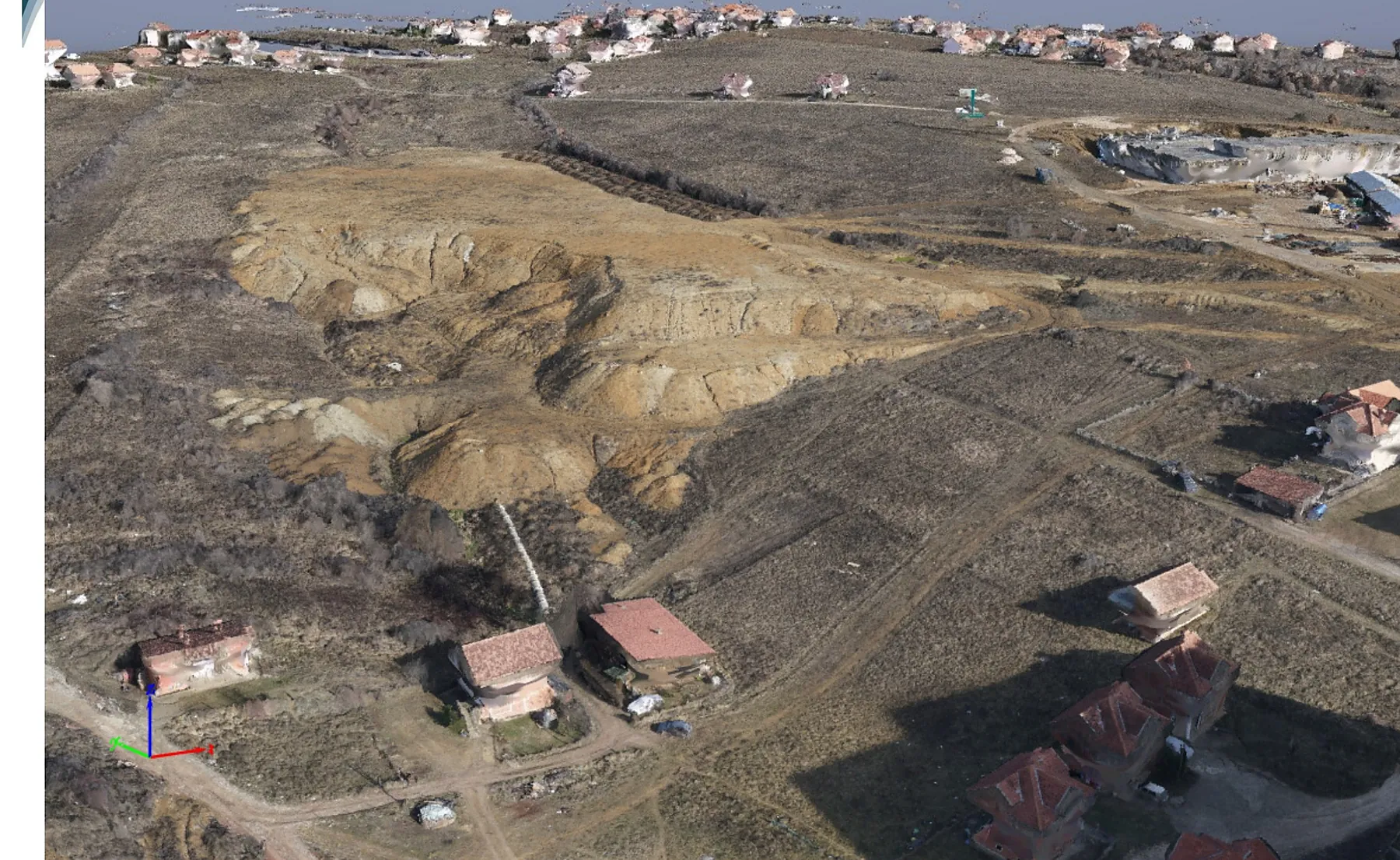
One flight, 272 million points
In January 2020 we flew the Kodrina neighbourhood of Prishtina (Matiçan cadastral zone) with our WingtraOne PPK drone. Here is how one flight becomes data an engineer can use.
- area surveyed
- 54.65 ha
- flight length
- 15.39 km
- flight altitude
- 200 m
- images
- 246
- per pixel
- 2.53 cm
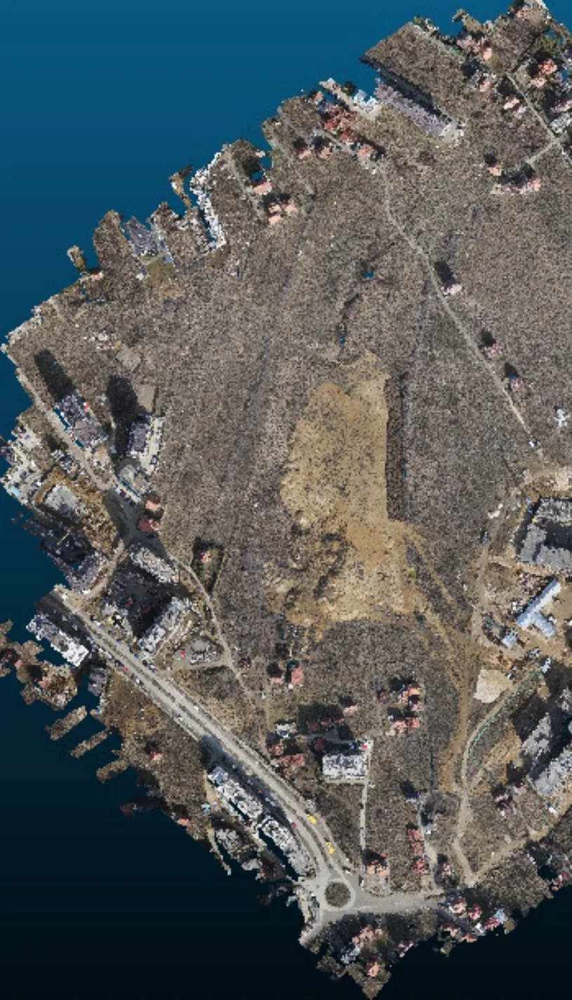
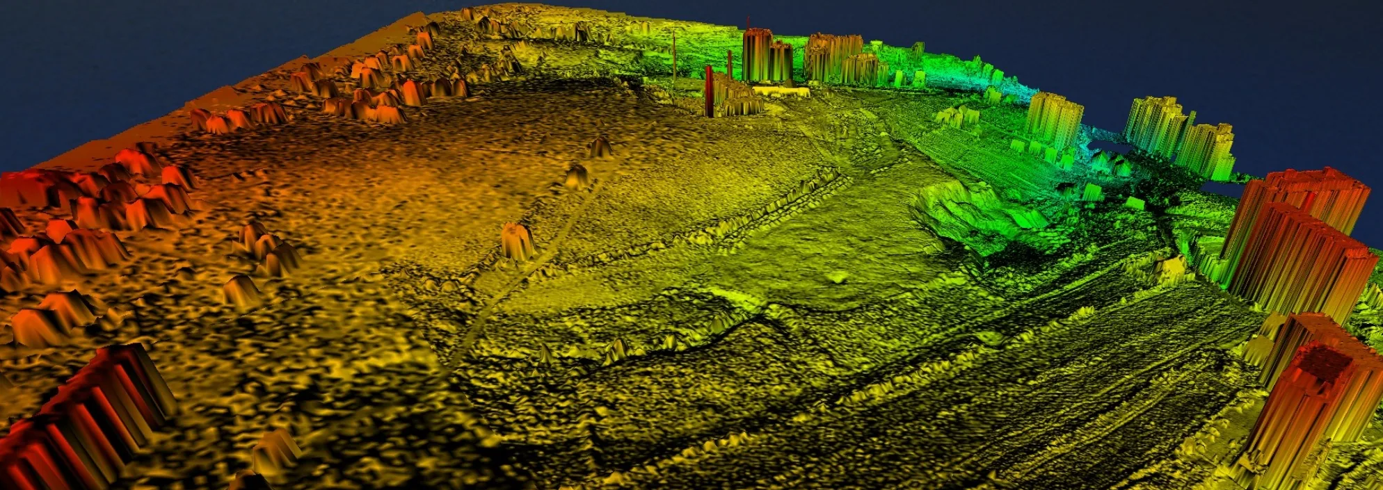
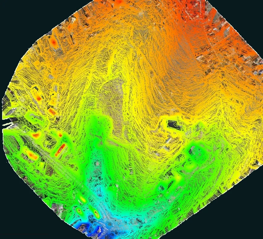
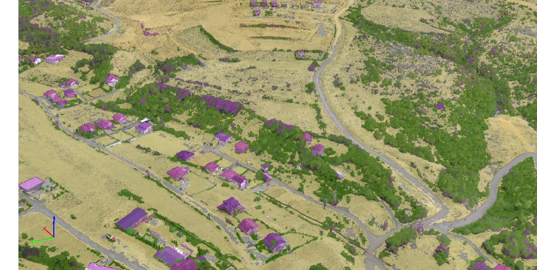
Imagery and data are delivered 1 to 5 days after the flight, in CAD or GIS formats.
Where we apply drones and GIS
Cadastre, surveying and GIS
- 2D orthomosaics from aerial imagery
- Cadastral layouts
- Land and terrain surveys
- Elevation and contour lines
- Road surveys, existing and for design
- Overhead and underground infrastructure: power, telecom, water
Surface excavation and mining
- Stockpile inventory and volumes
- Pit planning and monitoring
- Road construction monitoring
- Channel and embankment slopes
- Flood risk and forecasting
Design and construction
- Accurate cut, fill and haulage calculations (m² and m³)
- 3D site modelling before construction
- Tracking construction progress
- Catching costly problems early
Agriculture and environment
- Plant health (NDVI index)
- Plant volume and counts
- Urban expansion and agricultural impact
- Agricultural land classification
- Environmental impact of human activity
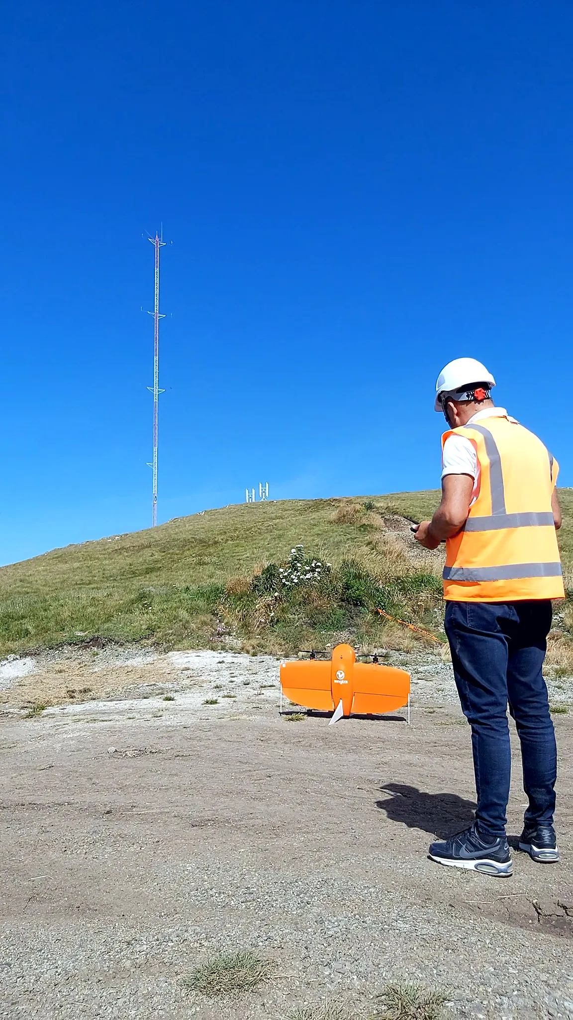
WingtraOne PPK and GEN II
The WingtraOne VTOL mapping drone performs fast aerial surveys over wide or hard-to-reach areas and produces reliable maps with high resolution and accuracy. Sony high-resolution or MicaSense multispectral cameras swap easily in the field.
The WingtraOne GEN II continuously checks every critical component before and during the flight, and can carry an oblique camera for 3D reconstruction and a PPK GNSS receiver for centimetre-level accuracy.
Drone projects
-
2024
Joos-Krasniqi Sh.p.k. · BOOST Kosovo
Multispectral drone monitoring of orchard health, Junik
Drone survey with sensors and a multispectral camera over 15.76 ha of orchards in Junik: apples (2.51 ha), blueberries (3.62 ha) and cherries (9.63 ha). NDVI maps show plant health, support early disease detection and help boost yields in a cost-effective, sustainable way. The project is part of the Kosovo Green Challenge NextGen – BOOST Kosovo programme, with Innovation Centre Kosovo, UNDP Kosovo, Agro Portal, Luna sh.p.k. and Joos-Krasniqi Sh.p.k.
-
2022
Prishtina
3D model of the Kodra e Trimave neighbourhood
WingtraOne GEN II flight with an oblique Sony a6100 camera and a 3D model of the Kodra e Trimave neighbourhood in Prishtina (December 2022). 3D data is essential for any city on the path to digital transformation: it lets city officials, urban planners, engineers and architects design urban environments with a better quality of life, plan critical infrastructure and simulate the effect of environmental changes. Team: Argjent Nela, Adriatik Sejdiu, Egzon Berisha.
-
2021
DT Global · USAID KESS
UAV topographic survey to assess rooftop solar PV potential
Unmanned aerial vehicle (UAV) topographic survey to assess the potential for rooftop solar photovoltaics. Under the USAID Kosovo Energy Security of Supply (KESS) project, DT Global provides technical assistance across the Kosovo energy sector, primarily to the Ministry of Economy.
-
2020
NOTUS Energy Kosovo
Bajgora wind park, 105 MW: geodetic survey and supervision
Geodetic measurement and supervision for the "Bajgora Wind Park – 105 MW" project (Selac 1, 2 and 3).
-
2020
NOTUS Energy Kosovo
UAV survey of Selac 2 and 3: 251.5 ha
Seven UAV flights covering 32.9, 44.6, 37.9, 47.8, 45.2, 24.7 and 18.4 ha, 251.5 ha in total.
-
2020
ENG Group
"Park of Peace", Obiliq and Fushë Kosovë: UAV survey
UAV flight and survey for the "Park of Peace" project in the municipalities of Obiliq and Fushë Kosovë, about 200 ha.
Have a project in the field?
Cadastral survey, drone mapping or a GIS system: tell us what you need and we will send a quote within one working day.