
ITEG Projects
Projects
A selection of our work from 2009 to 2021, for public institutions, international organisations and private companies.
-
2024
Joos-Krasniqi Sh.p.k. · BOOST Kosovo Multispectral drone monitoring of orchard health, Junik Surveying and UAV
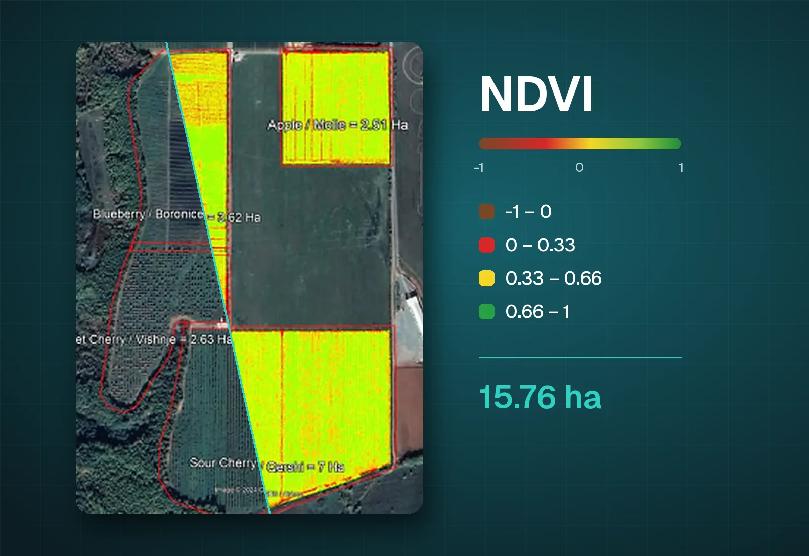
Drone survey with sensors and a multispectral camera over 15.76 ha of orchards in Junik: apples (2.51 ha), blueberries (3.62 ha) and cherries (9.63 ha). NDVI maps show plant health, support early disease detection and help boost yields in a cost-effective, sustainable way. The project is part of the Kosovo Green Challenge NextGen – BOOST Kosovo programme, with Innovation Centre Kosovo, UNDP Kosovo, Agro Portal, Luna sh.p.k. and Joos-Krasniqi Sh.p.k.
-
2023
Kramovik, Municipality of Rahovec Landscape survey of public land for solar potential GIS and cadastre
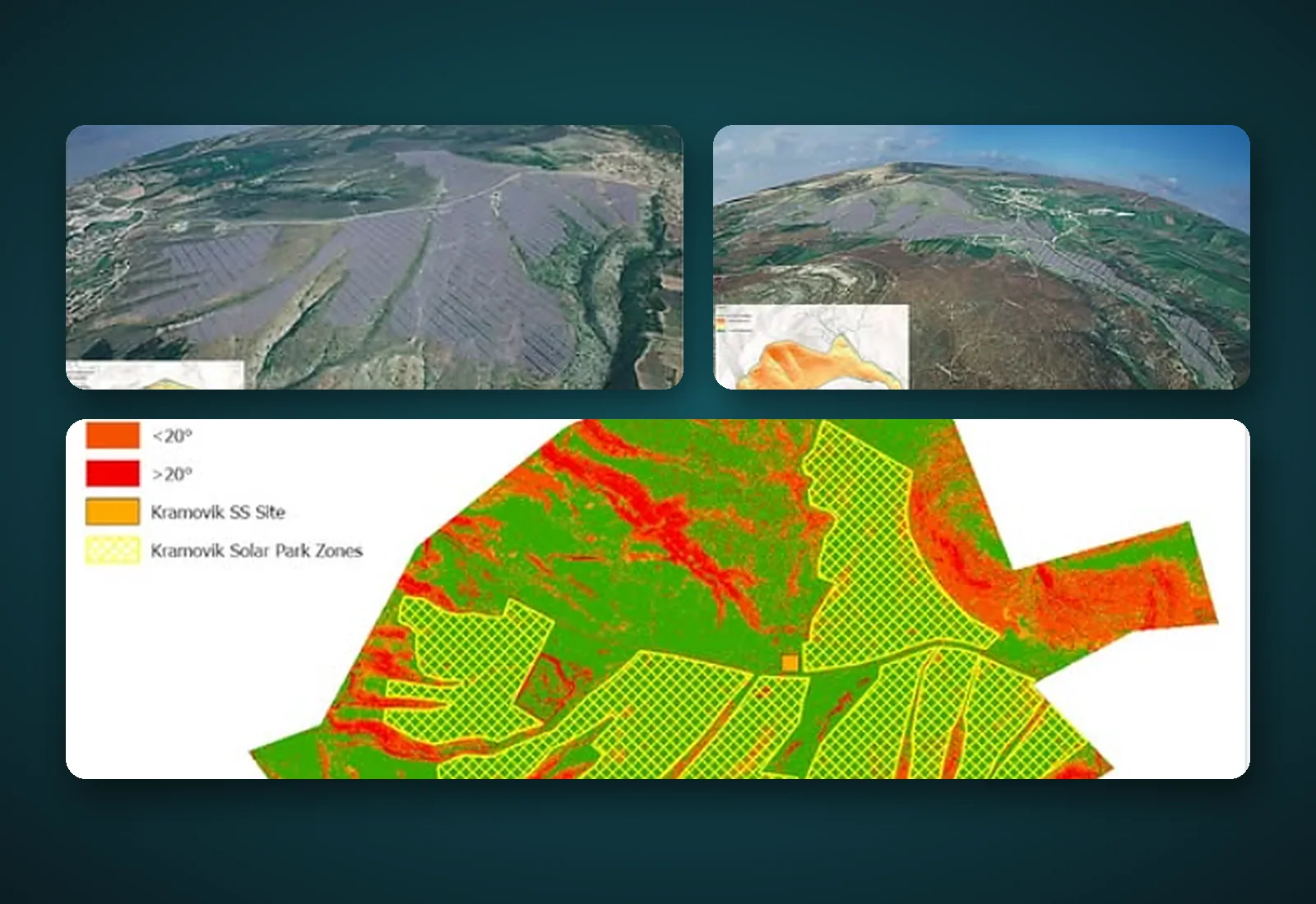
A detailed surface analysis using three-dimensional modelling tools, including sun modelling and sun exposure analysis. It identified a suitable site for a solar plant of more than 100 MWp on over 100 ha, with more than 250,000 south-facing panels, plus 30 ares for an air-insulated substation (AIS) at a calculated distance from the 110 kV line. The topography and landforms point to significant solar radiation potential, above initial expectations; the terrain is largely suitable for panels, there is no significant vegetation or other obstacles, and the land does not appear to be high-class agricultural land.
-
2022
Prishtina 3D model of the Kodra e Trimave neighbourhood Surveying and UAV
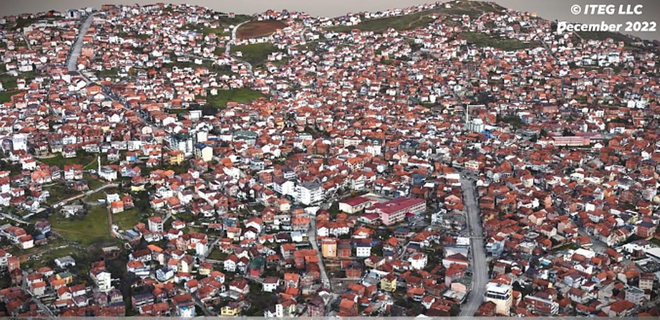
WingtraOne GEN II flight with an oblique Sony a6100 camera and a 3D model of the Kodra e Trimave neighbourhood in Prishtina (December 2022). 3D data is essential for any city on the path to digital transformation: it lets city officials, urban planners, engineers and architects design urban environments with a better quality of life, plan critical infrastructure and simulate the effect of environmental changes. Team: Argjent Nela, Adriatik Sejdiu, Egzon Berisha.
-
2021
DT Global · USAID KESS UAV topographic survey to assess rooftop solar PV potential Surveying and UAV
Unmanned aerial vehicle (UAV) topographic survey to assess the potential for rooftop solar photovoltaics. Under the USAID Kosovo Energy Security of Supply (KESS) project, DT Global provides technical assistance across the Kosovo energy sector, primarily to the Ministry of Economy.
-
2020
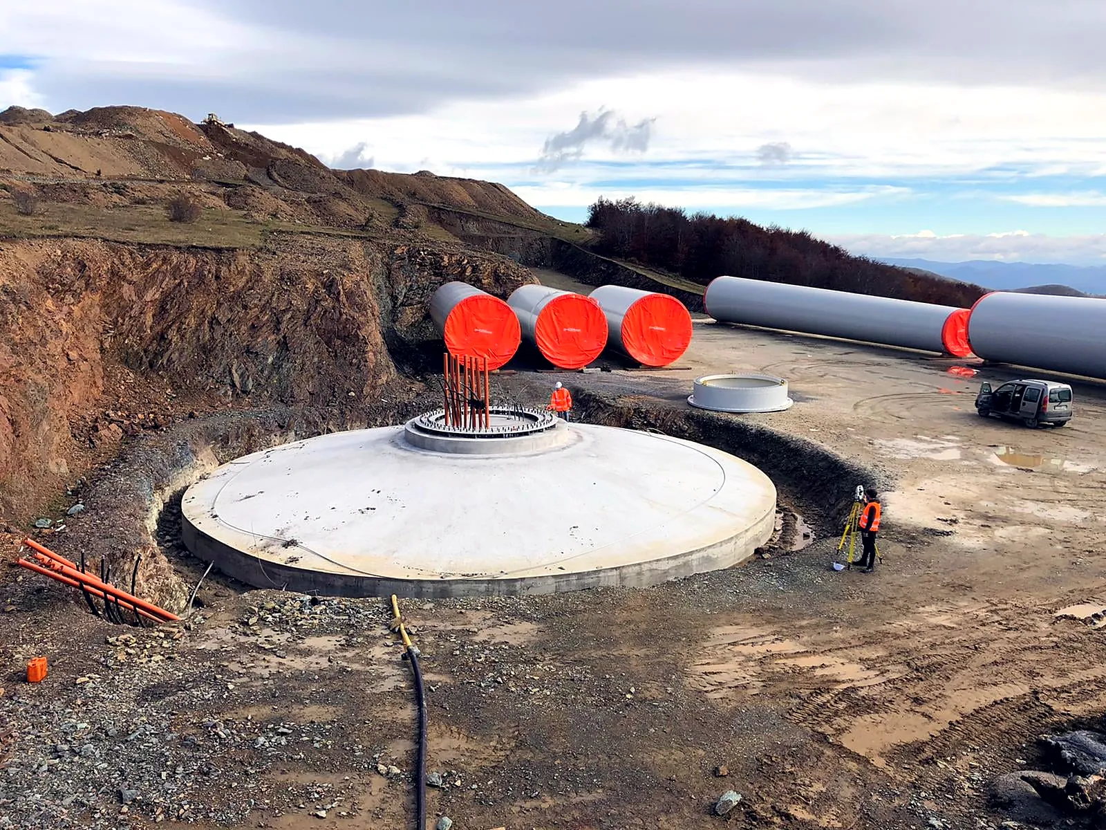
NOTUS Energy Kosovo Bajgora wind park, 105 MW: geodetic survey and supervision Surveying and UAV
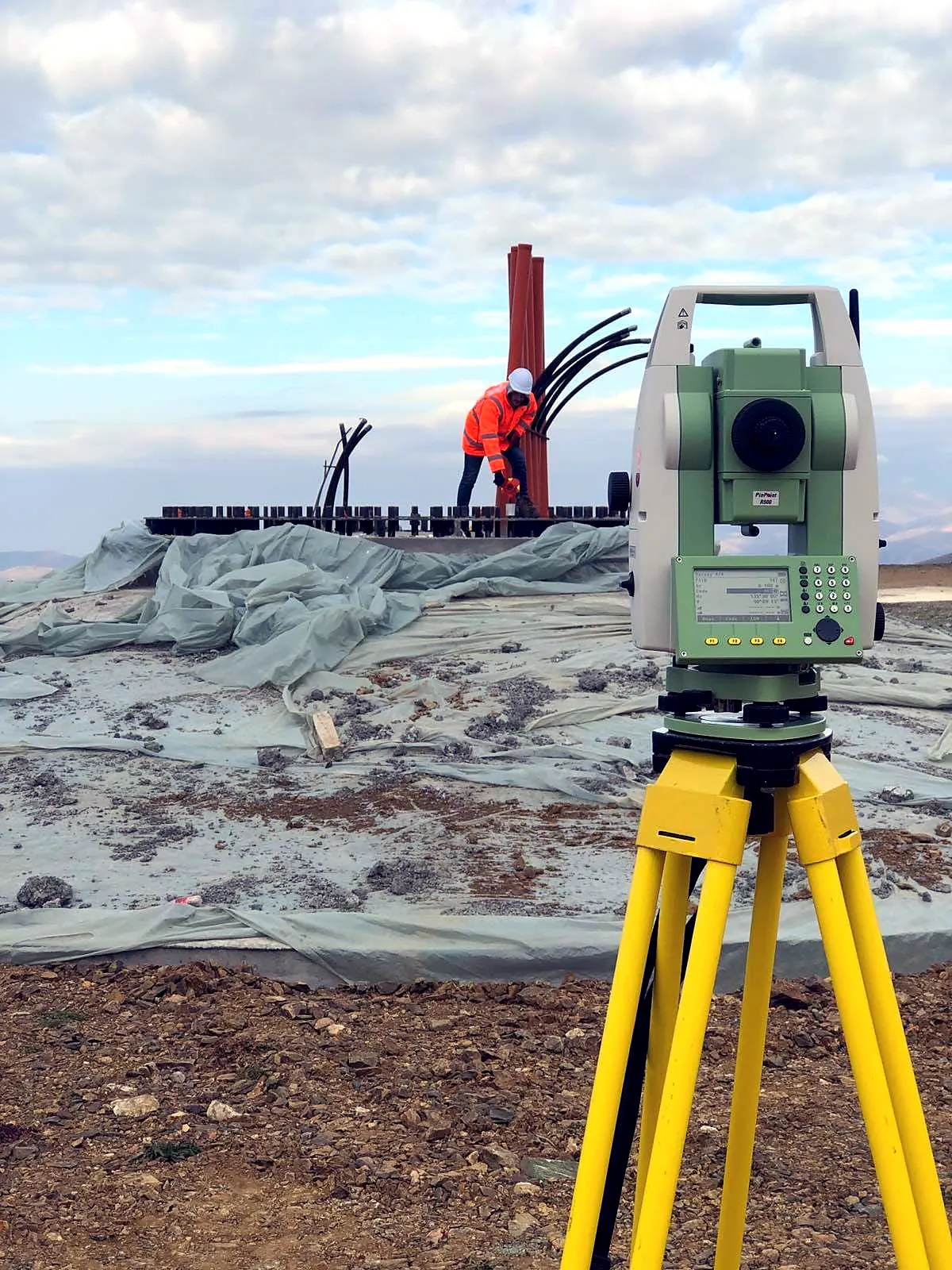
Geodetic measurement and supervision for the "Bajgora Wind Park – 105 MW" project (Selac 1, 2 and 3).
-
2020
NOTUS Energy Kosovo UAV survey of Selac 2 and 3: 251.5 ha Surveying and UAV
Seven UAV flights covering 32.9, 44.6, 37.9, 47.8, 45.2, 24.7 and 18.4 ha, 251.5 ha in total.
-
2020
ENG Group "Park of Peace", Obiliq and Fushë Kosovë: UAV survey Surveying and UAV
UAV flight and survey for the "Park of Peace" project in the municipalities of Obiliq and Fushë Kosovë, about 200 ha.
-
2009–2020
IPKO Telecommunications GIS for the GSM and HFC network, field surveys GIS and cadastre
To support decision-making at IPKO, we ran an intensive data capture programme: geodetic field surveys, feature extraction from aerial photography, overhead and underground fibre-optic infrastructure, GSM coverage, power supply to optical nodes, and door-to-door customer documentation for planning the new HFC network. The contract also covered documenting KEDS infrastructure and the technical acceptance of underground works.
-
2019
Municipality of Obiliq Feasibility study for district heating GIS and cadastre
Feasibility study for a district heating system for Obiliq and its surroundings, in a consortium with Enggroup. ITEG collected and digitised field data, determined building areas by use and function, and built the database for the detailed analysis.
-
2019
Municipality of Obiliq Cogeneration project Cartography and design
Research, analysis, consulting and preparation of the required documentation, plus professional services for the cogeneration project.
-
2019
UN-Habitat On-the-job training in spatial databases Training
The last of five practical training series for spatial database administrators and planning officers in Leposaviq, North Mitrovica, Zveçan and Zubin Potok (26 June – 9 July 2019).
-
2018
UN-Habitat ArcGIS 10.4 training, Mitrovica municipality Training
Training in ESRI products (ArcMap, ArcCatalog and ArcToolbox), five days of four hours each, as per the terms of reference.
-
2017
GIZ · EU EOM Kosovo 2017 Maps for the EU Election Observation Mission Cartography and design
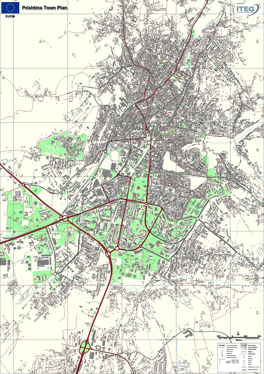
Map design: political map of Kosovo, municipality maps and town plans.
-
2017
UN-Habitat Land surveying and mapping in Mitrovica Surveying and UAV
Land surveying and mapping services in Mitrovica.
-
2017
Kaçanik Municipal Assembly Zoning maps for road designation GIS and cadastre
Zoning maps for the Municipality of Kaçanik, procurement no. 652-17-2498-2-2-1, "Designation of roads".
-
2017
World Bank Design and printing Cartography and design
Design and printing of cartographic material.
-
2017
Artmotion Map of Peja for fibre-optic planning Cartography and design
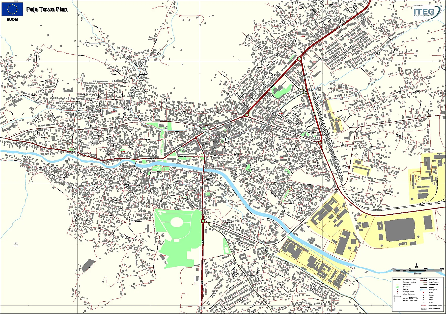
Preparation and printing of a map of Peja for fibre-optic network planning.
-
2014–2017
KOSTT Cadastral and legal services for the transfer of asset ownership GIS and cadastre
Three-year framework contract with a consortium partner: surveying every substation and power line with its assets, preparing the cadastral and ownership documentation, and registering KOSTT as legal owner with the municipal cadastral offices.
-
2016
Central Election Commission Digital election mapping platform IT and WebGIS
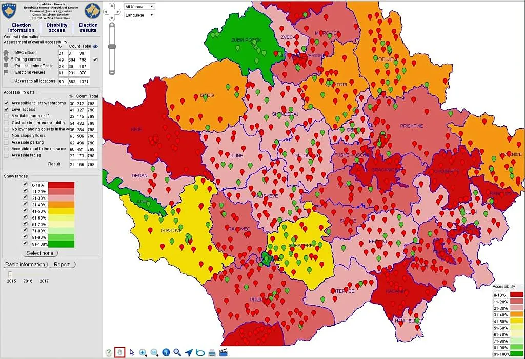
Module I: general election information at national, municipal and polling-centre level. Module II: disability access at polling centres, municipal election commissions, party offices and campaign venues. Module III: certified final results for every national and municipal election since 2000, ready for future elections.
-
2016
Montkomerce Geodetic surveys at 13 sites Surveying and UAV
Field and office work and map printing for: Cermjan – Culle, Nivokaz, Popoc, Ponoshec, Damanek, Duhel, Reshtan, Gjonaj, Neperbisht, Samadraxhe, Sopie, Lugbunar and Atmaxhe.
-
2016
NTSH Monting Geodetic surveys and project printing Surveying and UAV
Geodetic surveys and printing for: Varrezat-Vushtrri E1 and E2, Shupkofc, new substation Strehimore, Fidanishte, Koshtova E1, Tuneli i Parë (existing and new 400 kVA substation), Shaban Jashari E1 and E2, Riza Mala (existing and new substation).
-
2016
SOWI Kosovo Field survey team, office work and map printing Surveying and UAV
Field work with a survey team, office processing and map printing.
-
2014–2015
Perkins Eastman, New York 3D building renderings Cartography and design
From sketches and REVIT drawings, photorealistic 3D exterior and interior renderings, including Flushing Commons: models of buildings, façades and landscape, lighting, materials and textures, final rendering and post-production.
-
2014
RECURA Field data collection: elevators and markets GIS and cadastre
Recording every elevator in collective housing across Kosovo for an international investor's business plan, and every hypermarket, supermarket and market for a market analysis. Each one was shown as a point on the GIS platform with photos of its condition.
-
2013
UN-Habitat ArcGIS 10.1 training for municipalities Training
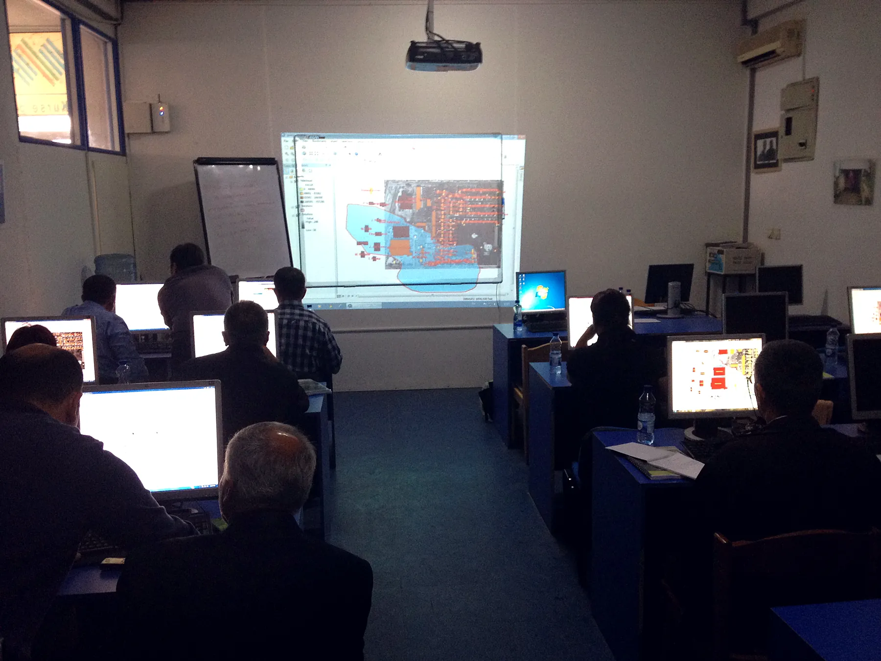
Training in ArcMap, ArcCatalog and ArcToolbox for staff of the Ferizaj, Graçanica, Mitrovica and Prishtina municipalities, five days per course.
-
2013
ARKEP · Kujtesa · PTK WebGIS and ArcGIS training for operators Training
WebGIS training for ARKEP and Kujtesa, and ArcGIS 10.1 training for Post and Telecom of Kosovo, five days of four hours each.
-
2013
UN-Habitat Thematic maps for Partesh municipality GIS and cadastre
Six thematic maps for each cadastral zone, 18 in total, and six maps of the whole municipality at 1:20,000, in A3 and A2 formats.
-
2011–2013
Regional Water Company Mitrovica Information management consultancy for water supply GIS and cadastre
Reviewing and updating the asset inventory in GIS, organising and supervising block mapping to build a new customer connection database, and building the GIS section's capacity to full autonomy. We also replaced the internal network with UTP and fibre optics.
-
2011
Regional Water Company Prishtina · Lahmeyer International WebGIS development and installation IT and WebGIS
A WebGIS application on the utility's Linux CentOS server with Apache and MySQL, web server and firewall, automatic periodic backups, and a custom tool linking the customer database to GIS. We also migrated the internal network to fibre optics.
-
2011
ARKEP WebGIS for all telecom infrastructure in Kosovo IT and WebGIS
An integrated WebGIS for the regulator, with a geodatabase designed from scratch: every operator's overhead and underground infrastructure, whatever the technology (HFC, coax, twisted pair, GSM antennas, transmitters), in one central system.
-
2011–2012
Geo Marketing Geographic business directory for Kosovo IT and WebGIS
A WebGIS geo-marketing portal with data collected for every kind of business in Kosovo and the region.
-
2012
USAID DEMI Municipal parcels: cadastral data extraction and property maps GIS and cadastre
Extracting cadastral vector data and zone boundaries from municipal offices (*.gws, *.dwg, *.shp), with discrepancy reports. Then municipal property maps over orthophotos in KosovaRef01: 19 municipalities, 5,007 km² at 1:2,000, printed and delivered in 12 working days.
-
2012
Hotel Prishtina Official website with online booking IT and WebGIS
Design of the official Hotel Prishtina website, with an online booking system.
-
2010–2012
EUP and other clients Large-format printing Cartography and design
Architectural projects at every stage, printed at 1:50, 1:100 and 1:200 in A0 and larger formats, folded for delivery.
-
2010
UNDP · UN-Habitat Forest and grassland mapping, Dragash and Prizren GIS and cadastre
Forest and grassland layers from remote sensing, 25 m contour lines and a 3D view of Prizren and Dragash (March 2010).
-
2009
USAID National map of USAID-funded projects GIS and cadastre
All projects on one A0 map and each sector's projects on A4: data entry, cleaning and processing from digital and paper sources.
-
2009
Kosovo Customs Reconfiguring and maintaining CISCO equipment IT and WebGIS
Reconfiguring CISCO equipment across Kosovo, with maintenance and training for the customs IT department.
Clients and partners

























Have a project in the field?
Cadastral survey, drone mapping or a GIS system: tell us what you need and we will send a quote within one working day.