
GIS and WebGIS
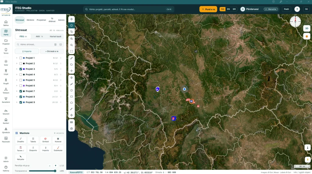
We build spatial databases, digitise maps and plans, run analyses, produce thematic maps and develop WebGIS platforms for municipalities, institutions and companies.
About this service
Since 2009 we have built GIS systems for telecom operators, municipalities, institutions and international organisations: from the IPKO GSM and HFC network to the digital election mapping platform for the Central Election Commission.
We work with QGIS, ArcGIS and databases such as SQL Server, and build WebGIS platforms in the browser and tablet apps for field data collection.
What we do in GIS
- Spatial databasesData models for networks, property, infrastructure and projects.
- DigitisationTurning maps, plans and surveys into GIS layers.
- Analysis and thematic mapsSpatial analysis and clear maps for decisions and reports.
- WebGIS and field appsBrowser and tablet platforms to view and collect data.
How we work
- 01Get in touchTell us the location and what you need.
- 02A quote within a dayWe send the price and next steps within one working day.
- 03DevelopmentWe prepare the data, analyses and platform to your needs.
- 04Handover and trainingWe hand over the data and train your staff to use it.
Why ITEG
- Licensed by the Cadastral AgencyKosovo Cadastral Agency licence no. 356.
- Since 2009Over 200 projects for institutions, international organisations and companies.
- Modern equipmentGNSS receivers, total stations and WingtraOne drones.
- A quote within a dayA reply with price and next steps within one working day.
We work in every municipality in Kosovo: Prishtina, Prizren, Peja, Gjakova, Mitrovica, Ferizaj, Gjilan, Podujeva, Vushtrri, Fushë Kosovë, Lipjan, Drenas, Rahovec, Suhareka, Malisheva, Kaçanik, Obiliq and the rest.
Frequently asked questions
How much does it cost?
It depends on the area, location and type of work. Send us the details and we will give you an exact quote within one working day.
Do you work outside Prishtina?
Yes, we work in every municipality in Kosovo.
How do I start?
Write to us through "Request a quote" or give us a call. We will tell you the next steps.
Have a project in the field?
Cadastral survey, drone mapping or a GIS system: tell us what you need and we will send a quote within one working day.